


Jun 30, 2025 02:06 PM IST
Most wildfires become unstoppable before we even know they exist. New satellite technology promises 20-minute global surveillance.
Remember the Uttarakhand forest fires that raged for weeks in 2016? Or the massive blazes that swept through Himachal Pradesh last year? The pattern is always the same – by the time we spot most wildfires, they’re already unstoppable monsters consuming thousands of hectares.
")
Current wildfire detection systems miss about 85% of fires during their first crucial hours when they’re still small enough to contain easily. Most detection happens through frantic calls to local authorities from villagers who spot smoke or forest guards on patrol routes. Ground-based camera networks cover barely 5% of at-risk areas globally.
Space might actually change everything
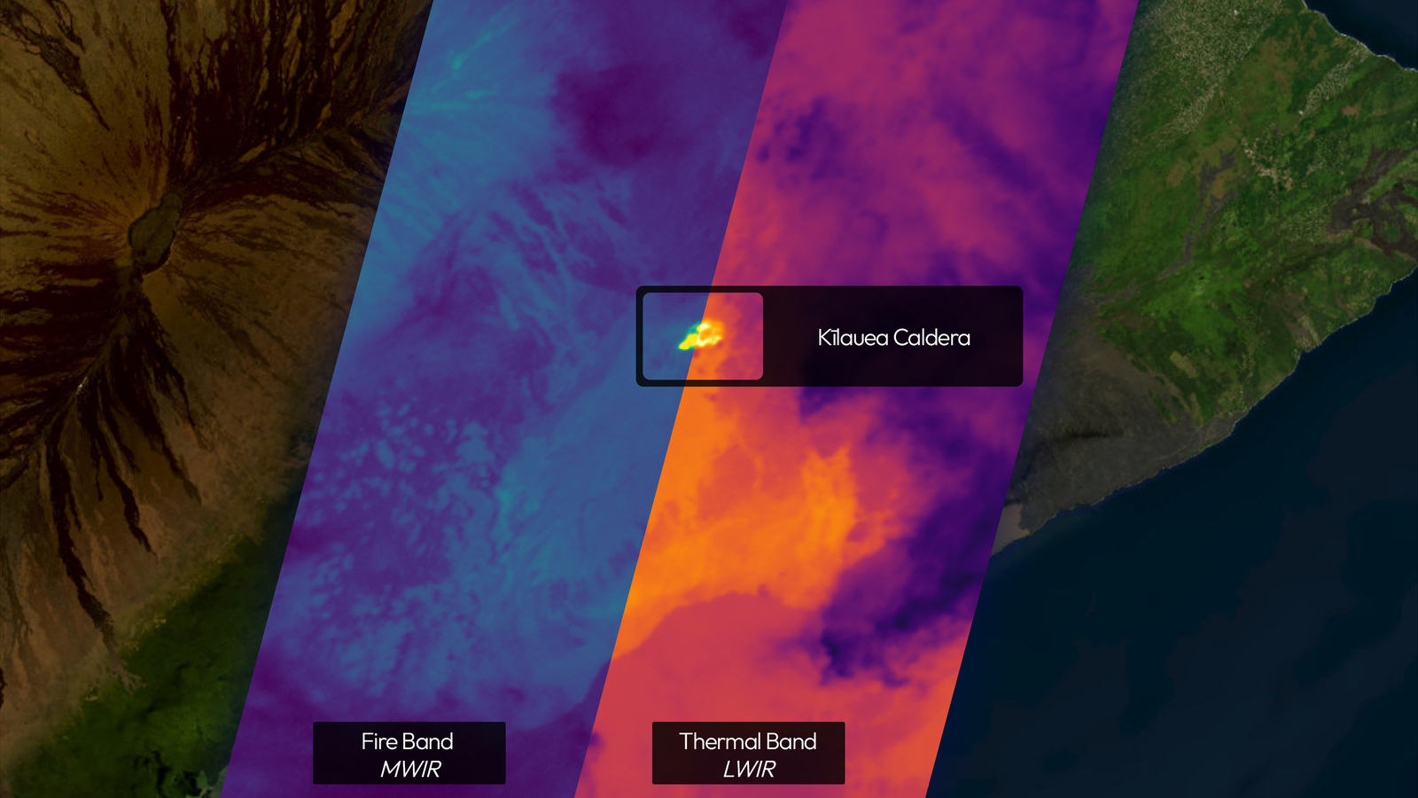
Here’s where it gets interesting. A new constellation called FireSat just proved it can spot fires smaller than a tennis court from over 600 kilometres above Earth. The first test satellite launched this year has been sending back thermal images that show heat signatures invisible to human eyes.
What makes this different from existing weather satellites is the refresh rate. The full constellation will scan every spot on Earth every 20 minutes, with fire-prone areas getting checked even more frequently. Current satellites might pass over the same area once or twice per day.
The technology uses six different infrared channels to filter out false alarms. Hot roads, metal rooftops, and even cooking fires in rural areas can trigger older systems. This new approach can tell the difference between a farmer burning crop stubble and an actual forest threat.
The real game changer
Beyond just spotting fires faster, this system could predict where flames will spread next. Real-time data on fire intensity, wind patterns, and fuel moisture could help firefighters position resources hours before flames arrive. Instead of always playing catch-up like we saw in California, emergency teams might finally get ahead of disasters.
The first prototype images captured volcanic activity in Hawaii and industrial flares in Libya with startling clarity. If 50 satellites can deliver this quality of data continuously by 2030, wildfire response could shift from reactive damage control to proactive prevention.
Early detection systems in other fields have proven transformative – medical screening catches diseases before symptoms appear, earthquake sensors provide crucial warning seconds. Wildfire detection has been stuck in the stone age by comparison.
Whether this technology scales up successfully remains uncertain. But with fire seasons getting longer and more destructive worldwide, having constant surveillance from space might be our best shot at staying one step ahead of the flames threatening our forests.


