


HELSINKI, March 3, 2026 — ICEYE, a global leader in disaster intelligence from space, today announced the launch of its deforestation monitoring solution. This technology is designed to provide law enforcement agencies, government officials, and conservation organizations with near real-time visibility into forest loss, even in the most cloud-covered regions of the world.
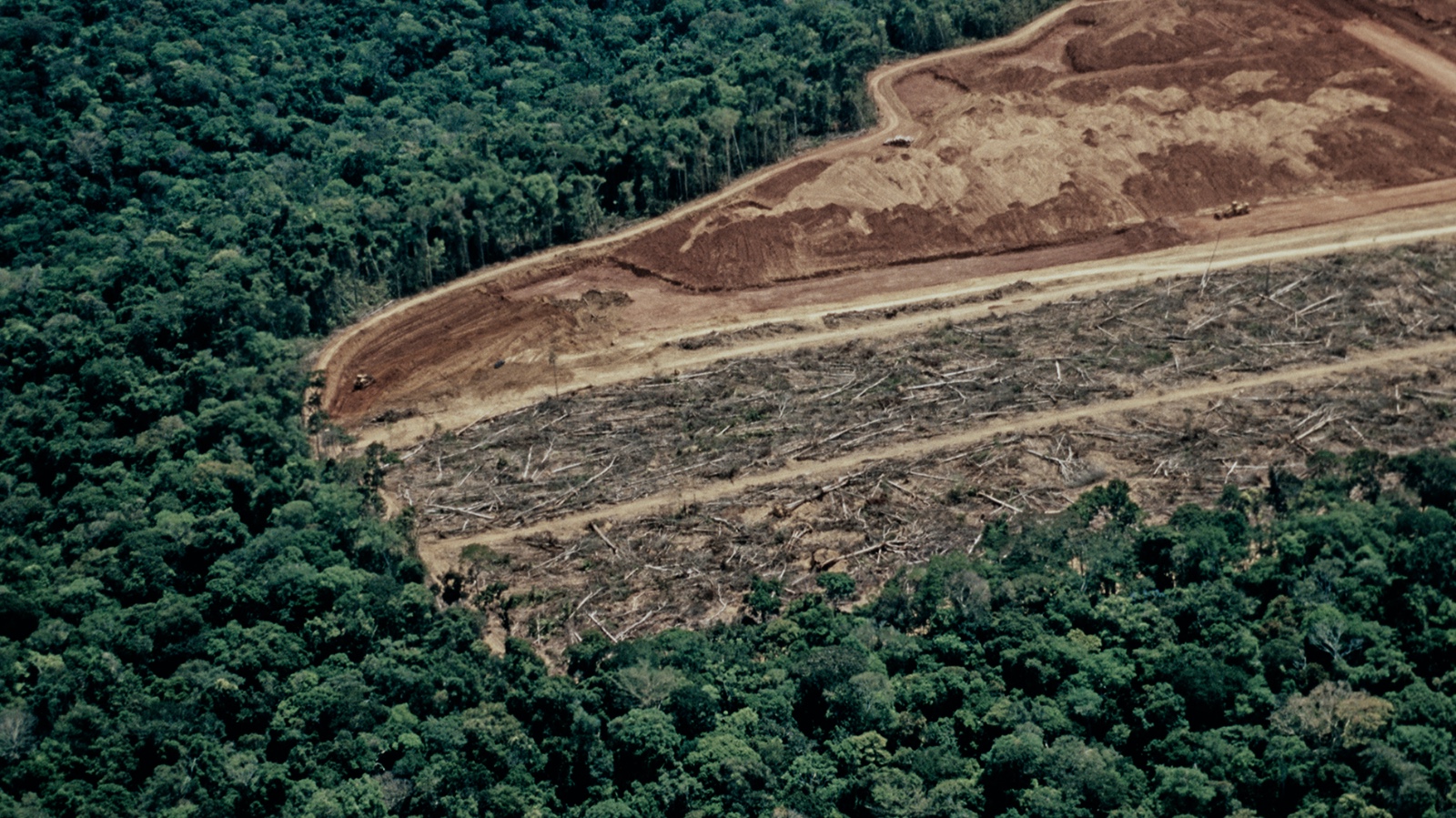
The launch comes amid sustained pressure to protect the Amazon rainforest. According to Global Forest Watch, Brazil lost 28 million hectares of tree cover between 2000 and 2020, a nearly 6% net decline, reflecting a long-term trend that continues to challenge enforcement efforts in remote and cloud-covered regions. While enforcement efforts have reduced deforestation from peak levels seen earlier this decade, illegal clearing remains persistent and highly adaptive.
Traditional optical satellites often struggle in tropical regions where heavy cloud cover can obscure imagery for days or weeks at a time. These monitoring gaps create enforcement blind spots, limiting authorities’ ability to respond proactively when illegal clearing occurs. Without reliable evidence and verification, forest loss can expand before action is possible.
ICEYE’s synthetic aperture radar (SAR) constellation closes that gap. SAR imagery operates day and night through all weather conditions, providing persistent monitoring even in the cloudiest parts of the Amazon. The system delivers incremental deforestation detections with pre- and post-event imagery for a clear evidence trail.
“When forests are under threat, timing is everything,” said Andy Read, Vice President of Government Solutions at ICEYE. “SAR removes the blind spots that have historically limited monitoring and enables a continuous stream of trusted intelligence. That shift in speed and persistence is game-changing for the authorities and conservation partners responsible for protecting these landscapes.”
ICEYE has monitored forest change across Brazil for several years, observing deforestation patterns in remote regions where optical monitoring has been intermittent. The formal launch of this solution marks an expansion of ICEYE’s environmental intelligence capabilities to deliver structured, repeatable monitoring designed specifically for enforcement agencies, conservation NGOs, and government ministries.
“Reliable, persistent monitoring is critical for protecting wildlife and natural habitats,” said Dr. Lilian Pintea, Vice President of Conservation Science at the Jane Goodall Institute. “Illegal mining and deforestation are accelerating in remote regions. Access to near real-time, cloud-penetrating data strengthens our ability to document impacts, prioritize threats, and advocate for immediate action.”
ICEYE’s monitoring supports the full ecosystem of forest protection, from NGOs’ advocacy and donor transparency to national climate reporting and environmental compliance. Meanwhile, enforcement agencies gain access to evidence-based deforestation data, enabling intervention during active operations.
As pressure on tropical forests intensifies, persistent and reliable monitoring is foundational to global conservation efforts. ICEYE’s approach links continuous monitoring with forward-looking analytics to support long-term conservation strategies in Amazonia, Congo Basin and other threatened forest biomes around the world.


